Gaspé Navigation Guide
Gaspésie offers 3 port options

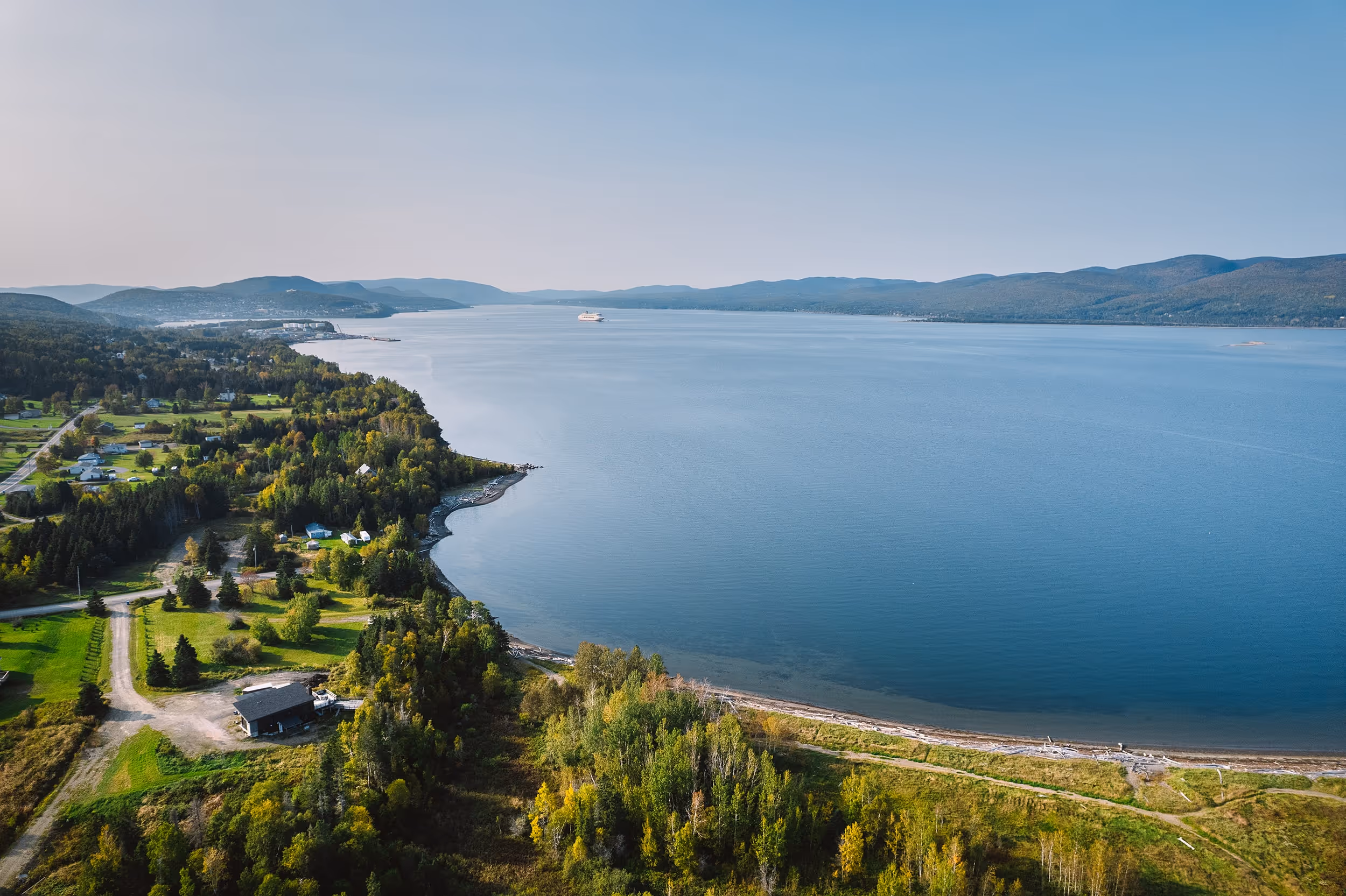
Anchoring in Gaspé
The dock offers a breathtaking view of the bay and downtown Gaspé. A few steps from the docks is the cruise terminal, where tour buses depart and tourist information is available. With map in hand, visitors can stroll through the town to visit points of interest that tell the story of the Mi'gmaq First Nations and the activities of the Irish, French and English in the region from the arrival of Jacques Cartier in 1534. Cruise terminal Tourist information 15-minute walk from downtown Gaspé (1.1 km)
Tidal movement:
Pilots :
Tendering :
Landing docks :
Tender Port Area Port is certified ISPS Secure anchorage position:
Drone :
Useful information
- Parc national Forillon
- Rocher Percé
- Cap-des-Rosiers lighthouse; the highest in Canada
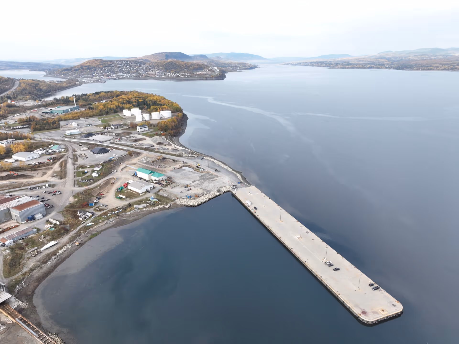
Quai de Sandy Beach Gaspé
Landing docks :
Port services
- Fuel per truck
- Fresh water per truck
- Minor repairs available
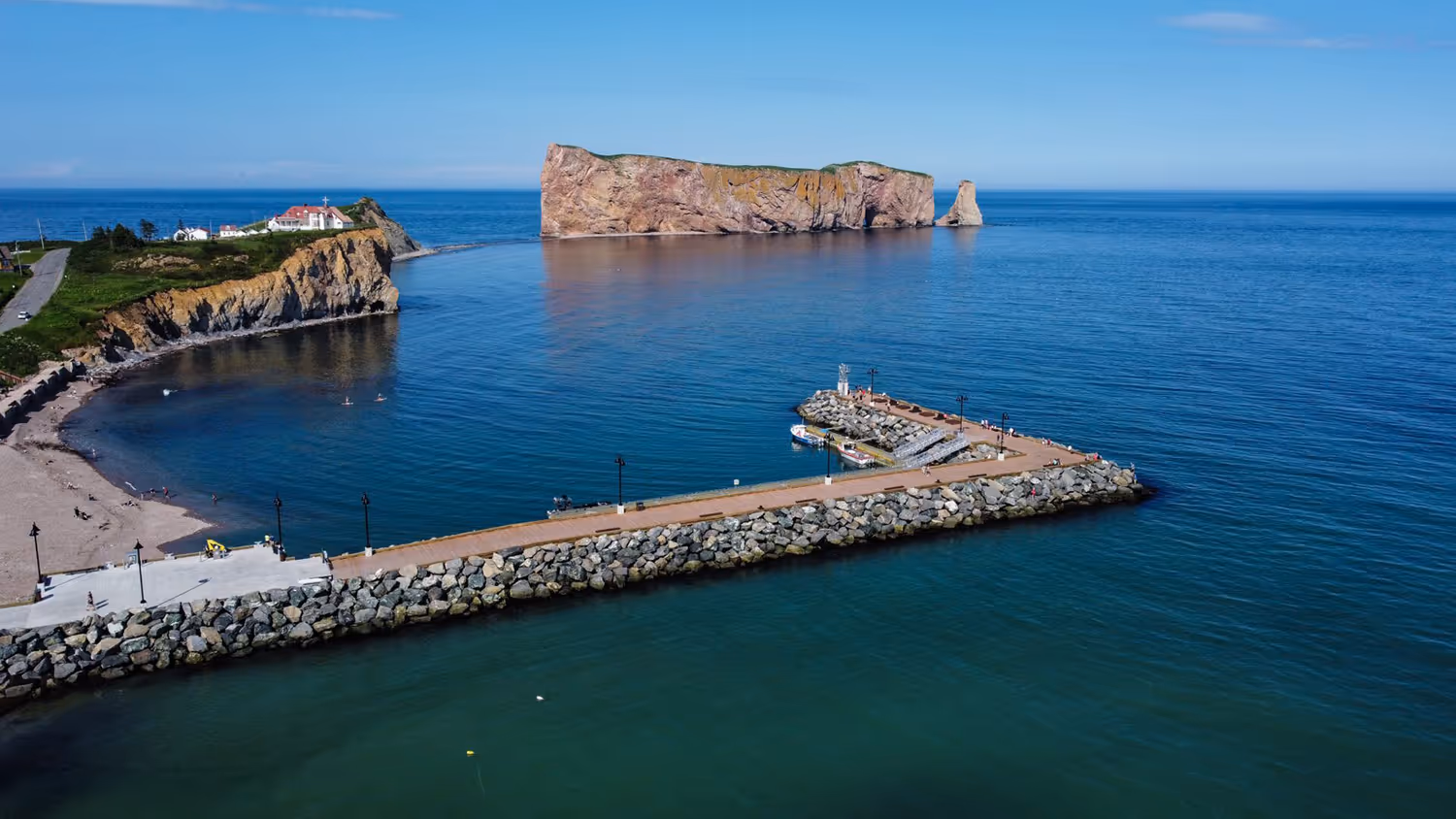
Anchoring in Percé
Located at the tip of the Gaspé Peninsula, Percé offers a variety of activities and places to visit, including the Île-Bonaventure-et-du-Rocher-Percé national park, the Percé UNESCO GeoPark and seal diving. The ship will dock near the village center, where you can enjoy a pleasant stroll past restaurants, cafés and craft stores.
Over 700 passengers per event.
Landing docks :

Gaspé sustainable destination
Sustainable development at the heart of our destination
Escale Gaspé is committed to making sustainable development a central, cross-cutting element of its strategic planning. It is aligned with Croisières du Saint-Laurent's Sustainable Development Strategy and shares its vision for the St. Lawrence destination.
The cruise industry contributes to the socio-economic vitality of Quebec and its regions, while helping to preserve and regenerate ecosystems. The St. Lawrence destination offers a human and sustainable experience with a positive impact, through the bridges we build between visitors and host communities, maritime, tourism and scientific players.
Escale Gaspé has taken action in recent years in terms of sustainable tourism development. It has equipped its cruise lodge with waste-sorting islands and a boutique showcasing local products. It also broadcasts sustainable and responsible tourism awareness content for cruise passengers, via a screen located in its pavilion.
The organization also rolled out its first-ever stakeholder consultation forum in spring 2025, participates regularly in the sustainable tourism best-practice sharing community Les Courants Durables du Saint-Laurent, and takes part in a social acceptability campaign run by Croisières du Saint-Laurent.
Destination Gaspé's brand-new, optimized website also stimulates the local economy and enhances the tourism offering by improving the visibility and appeal of local businesses. It offers a modern, engaging showcase on a centralized platform, while integrating rich content linked to local stories and the region's unique cultural events.
